Metro Vancouver Regional Parks
Wildfire Risk and Forest Health Management
Metro Vancouver is taking a proactive, science-based approach to managing wildfire risks in response to projections of warmer, drier summers and increasingly severe wildfire seasons in British Columbia. Diamond Head Consulting (DHC) collaborated with Metro Vancouver to develop a comprehensive Wildfire Risk and Forest Health Management Framework across the Regional Parks system.
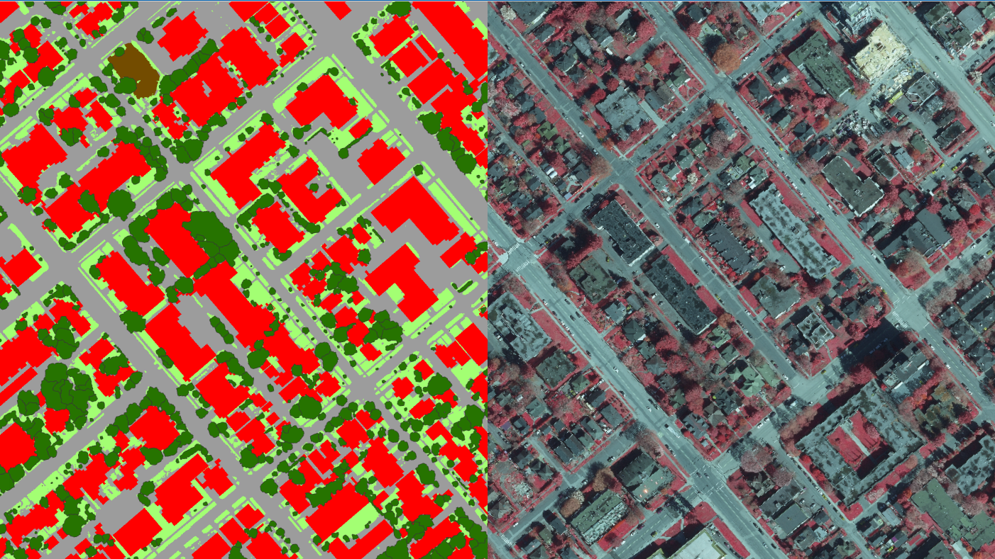
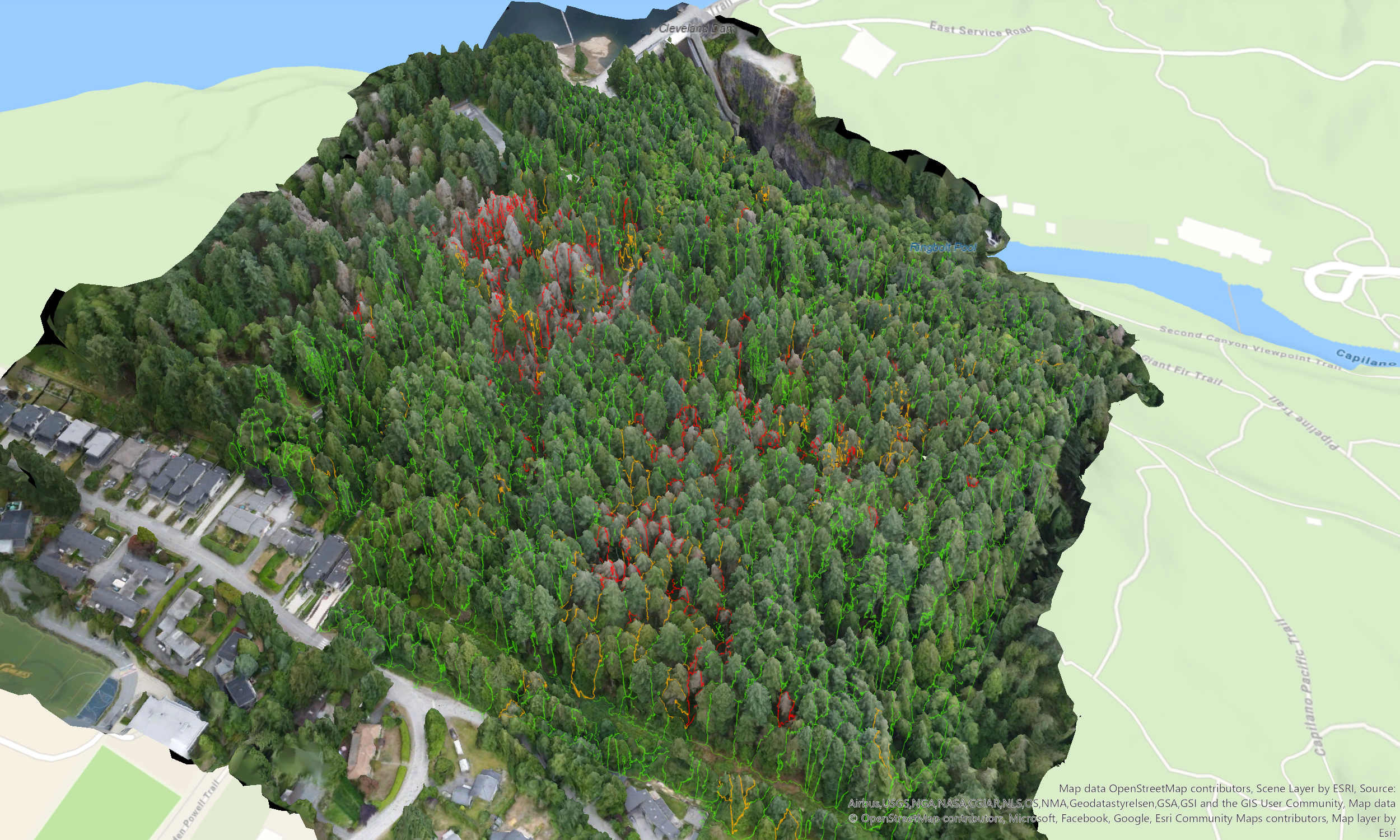
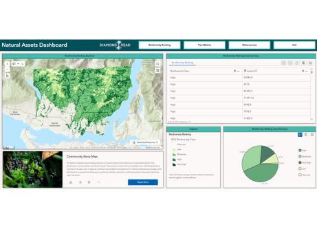
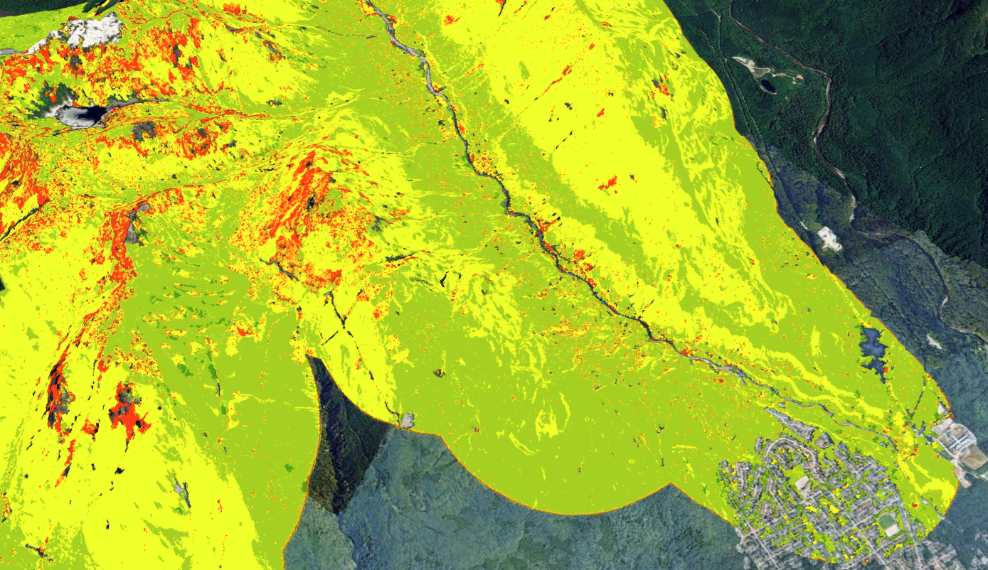
To achieve this, our geospatial team utilized LiDAR and multispectral imagery to map forest and canopy fuel properties—such as vertical fuel continuity and bulk density—in unprecedented detail. We then leveraged the US Forest Service's FlamMap fire behavior and analysis software to spatially model potential fire spread and fireline intensity across the complex landscape. Wildfire risk was rigorously evaluated by integrating these advanced fire behavior models with a detailed values-at-risk analysis, pinpointing exactly where hazardous fire behavior poses the greatest potential impact to critical infrastructure, buildings, and sensitive ecosystems.
Based on this robust spatial intelligence and field-based ecosystem assessments, the framework outlines strategic, landscape-scale recommendations to reduce wildfire risk and improve forest resilience. Key recommendations include spatially targeted fuel treatments, the selection of fire-resilient species, modifications to forest structure, and the establishment of pilot mitigation areas. Additionally, the framework addresses FireSmart building and landscaping practices, emergency preparedness, training, and public education. These efforts support the protection of public safety, ecological integrity, and recreational values, positioning Metro Vancouver’s Regional Parks system for long-term climate resilience.