Metro Vancouver
Upper Capilano Forest Assessment and Management Plan
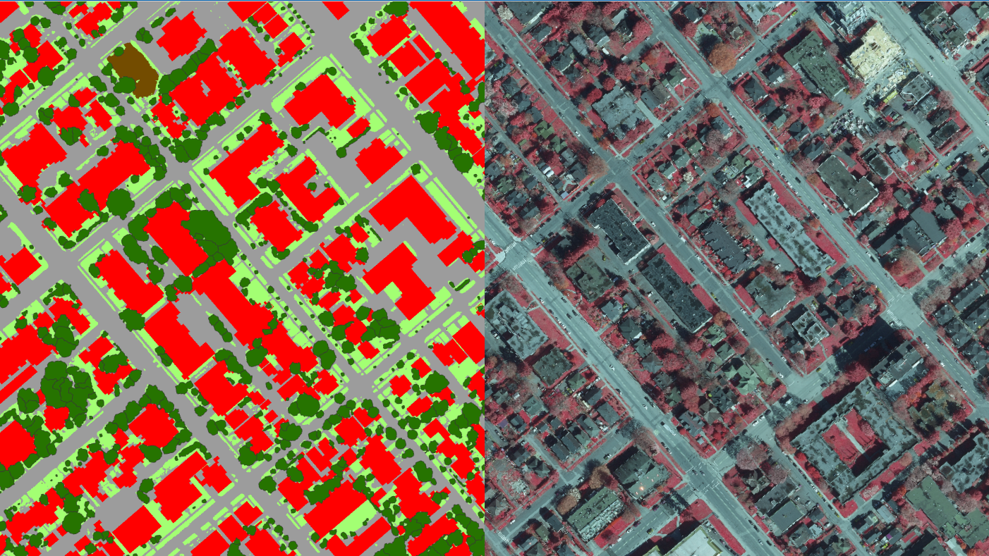
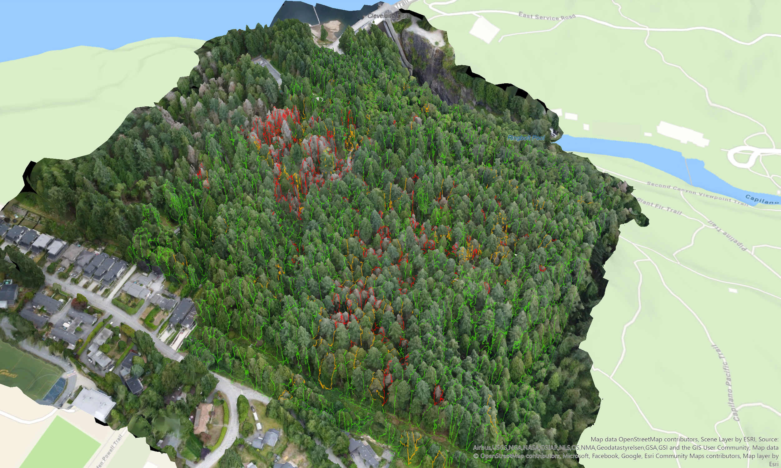
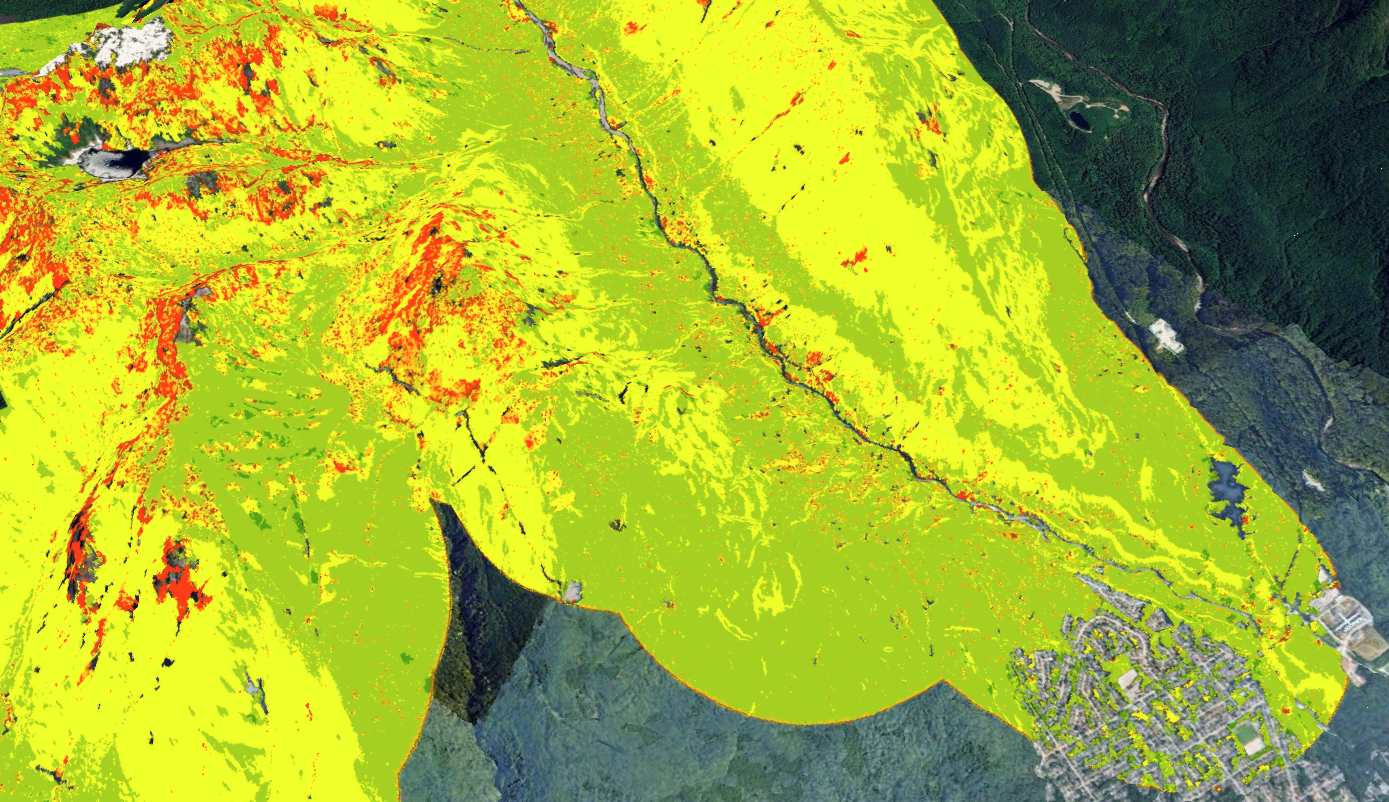
DHC evaluated widespread tree mortality and decline caused by a recent western hemlock looper moth outbreak and compounding severe summer droughts within the Capilano River Regional Park. To accurately quantify this environmental impact, our geospatial team utilized advanced drone surveying to generate a high-resolution 3D digital twin of the forest structure.
By integrating multispectral imagery with machine learning algorithms, we performed precise individual tree detection to map canopy gaps and automatically isolate dead and declining trees across the study area. Based on these rigorous spatial findings, the resulting management plan established clear operational strategies to mitigate elevated wildfire threats from accumulating ground fuels, remove highly defective and dangerous trees near trails and residential boundaries, and guide targeted ecological restoration planting to promote a climate-resilient forest.