
City of New Westminster
Urban Forest Management & Canopy Modeling
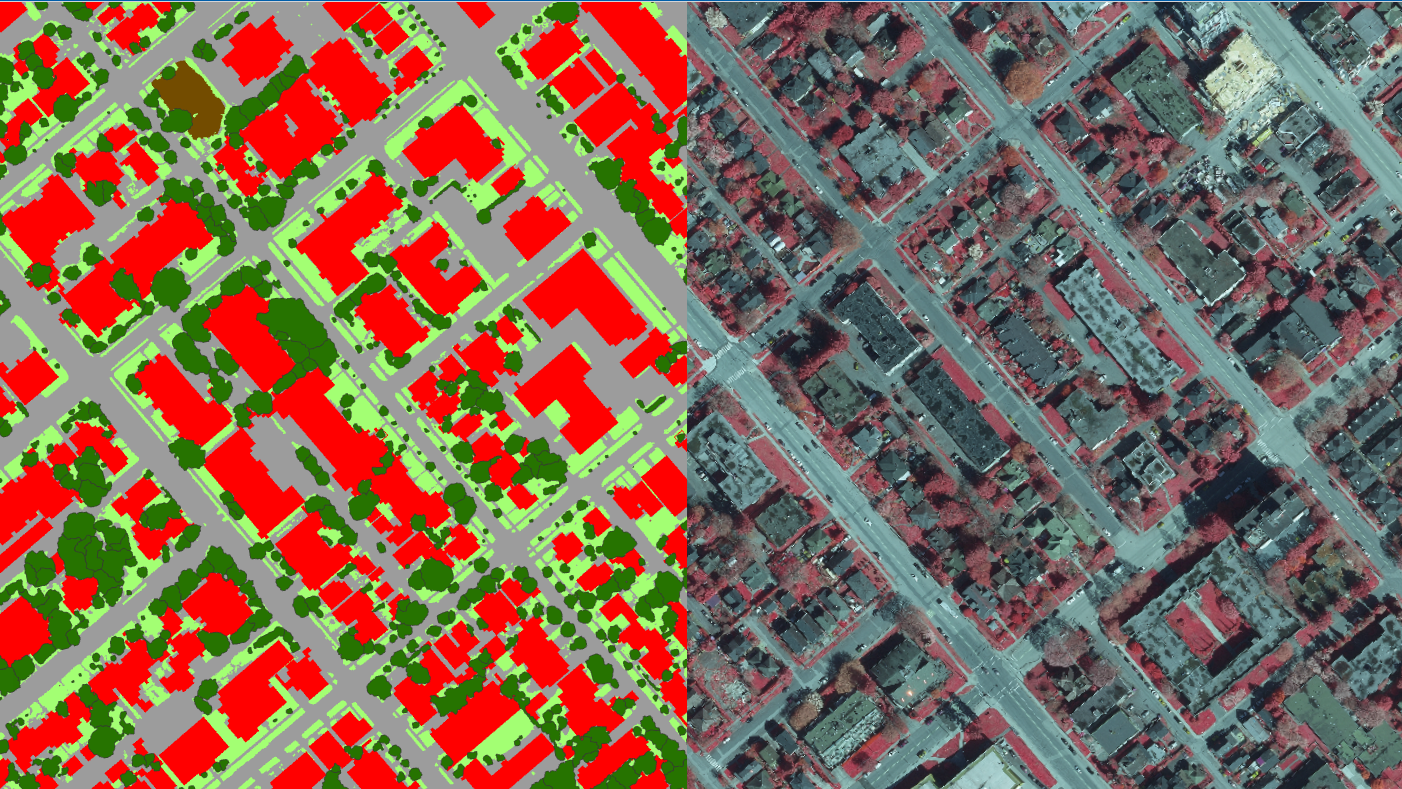
This project marked the most detailed and spatially accurate look into New Westminster’s urban forest. To achieve this, our geospatial team derived a comprehensive "digital twin" landcover dataset of the entire city. By modeling the existing urban canopy in high resolution, the report provided an in-depth look into canopy trends between 2016 and 2025, offering vital insight into the effectiveness of current urban forest management measures.
Beyond assessing baseline conditions, we utilized this digital twin to strategically model future planting opportunities across the city. We simulated new tree plantings within the spatial environment, allowing us to actively visualize and avoid utility conflicts, infrastructure, and biophysical constraints. This sophisticated modeling allowed us to realistically "grow" the urban canopy over time, identifying and ranking priority planting zones based on highly accurate, delineated plantable areas.
In addition, the report analyzed key tree metrics, including the number and average size of municipally managed trees, the location of the tallest trees, and the distribution of selected priority species. Ultimately, these advanced spatial simulations supported continued momentum in New Westminster’s urban forest management, equipping the City with a data-driven roadmap to realistically and effectively achieve its long-term canopy cover targets.